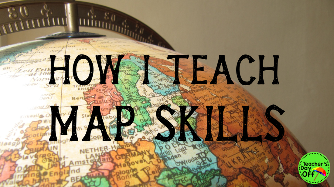
Map skills was one of my favorite social studies units to teach in 2nd grade. With everything becoming digital, it is easy to push this topic to the side if you don’t have enough time to cover all of the standards (which we never have enough time for). There are GPSs and Google Maps to tell you how to get everywhere, but using a map is still an important life skill to have. You still have to have some knowledge of maps to use digital maps. Plus, technology fails. A lot. I know my GPS has no idea where I am half of the time. So, it is still something that we need to teach our kids. Here's how I teach it:
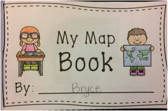
For a lot of my unit, I use the materials in my Where in the World? Map Skills Mini Unit (link at the bottom of the page), so most of the activities I talk about can be found in there. First, I teach an introductory lesson about maps. I make a map of the classroom and show it to my students and we talk about what a map is, what they can tell us, and why they are useful. Then, I spend the rest of the lesson introducing the vocabulary for the unit. In 2nd grade, I teach them:
This interactive reader is a fun way to introduce these vocab words, and it lets your students get a little practice using the features on maps.
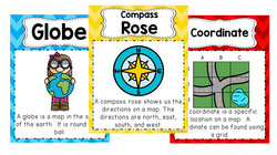
My map skills pack has anchor charts and picture vocab cards for all of these words that you can hang up to help your kids remember. Now, I know this might seem like a lot for a 2nd grader, but they are so capable. I found fun ways to introduce the words. For example, for key, I make a map of the classroom, but use random symbols to represent everything. I ask them what it was a map of, and naturally none of them can figure it out. Then, I show them a key, and asked them what the map was. Students then start to figure it out. After we talk about the vocab words, we practice finding map features on different maps on the Promethean board. I let the students come up and circle the items. They love being able to use the board! After this introductory lesson, I teach a lesson on keys. I think this is one of the map features the students need to learn first, because they have to know what they are looking at before there will be any point to them using coordinates or the compass rose. In the pack there is a fun color by item worksheet where the students use the key to color the items on the map the correct colors. This is a pretty easy skill for the kids to pick up on, and I only spent a mini lesson covering it. 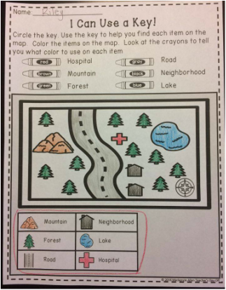
Next, I teach how to use a compass rose. This is by far the skill my students have the hardest time with, so I have had to do a lot of experimenting to figure out what works for them. I only teach north, east, south, and west. I don’t teach northwest, southwest, or anything like that. My high kids naturally pick up on this, but I never explicitly teach it. I first teach the kids what the directions are. I use the acronym Never Eat Soggy Waffles to help them remember the order of the directions on the compass rose. My students think this is hilarious, and they never forget it. To introduce how to use a compass, we do a treasure hunt activity (included in the pack) where the kids get to practice being “GPSs.” I place a card with a cardinal direction on the corresponding wall in my class. I send one student into the hall and have another hide a picture of a treasure chest. Then, the student comes back in and students take turns telling the student how to get to the treasure chest using only cardinal directions. It is a fun activity, and you can do it again and again. Then, we do a moving map activity. I draw a large rectangle on a whiteboard. I cut out different items that are typically on maps, such as a neighborhood, restaurant, forest, etc., that I print on paper. I cut out a compass rose and a key. I place all of these in the rectangle on the board to create a map. I use tape on the back of each paper, so they are easy to move around. I also cut out a picture of a kid that I place on the board, and I will tell you why in a second. Then, I hold up a sentence strip such as “The airport is ______ of the restaurant.” The students have to use the compass to figure out what cardinal direction goes in the blank. To help them do this, we first figure out where the kid is starting at and place them there on the map. So in this case, the kid would start at the restaurant. Then, we figure out what direction the kid needs to go to get to the airport. After practicing some as a class, you can turn it into a competition and have the students answer on whiteboards individually or in teams. After completing each sentence strip, I have a student come up and move items around on the map. This activity is great because it is like the kids are looking at a new map each time. Everything you need to do this activity is included in my pack. Coordinates is my favorite concept to teach in this unit. I do an activity called “Guess Where?” with my students, and they love it! (This is included in the pack.) The students cut out items and place them on a grid to create their own map. Then, they pair up with another student to play a game. The students bring their map with them and then get a blank grid where they are trying to recreate their partner’s map the fastest. They take turns guessing coordinates. If they guess a coordinate that has an item in it, their partner tells them what the item is, and they place the item on the blank grid. The first student to recreate their partner’s map, wins. 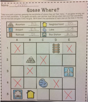
To teach the students about the continent, country, state, and city they live in, I first do a direct instruction mini lesson and show them where all of the places are on a map. Then, we do an atlas scavenger hunt. I had a set of small atlases in my class, so I paired my students up and had them work together to find our continent, country, state, and city, as many times as they could in the atlas and write down the page number. Give them a time limit and make it a “race” to get the students excited. It gives them great practice finding them on various maps.
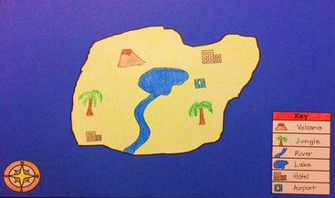
To close up the unit, I have my students create an island. I give them specifications for what the map needs to include, but then let them be as creative as they want. Then, you can have the students answer questions about their map. Included in my pack, along with the materials to have your students make an island map, is a fun writing extension to have your students persuade tourists to come to their island. This was my students’ favorite activity of the unit, and I think it is a fun way to finish up.
I hope this gave you some ideas of how to teach map skills in your class.
Happy Planning! Mackenzie Comments are closed.
|
AuthorHi! I'm Mackenzie. Teacher, wife, and Washingtonian. Check out my blog to get ideas and products for your class. Archives
December 2016
Categories
All
© Mackenzie Allen 2016.
ALL RIGHTS RESERVED. |
 RSS Feed
